
1953 Map of Oahe SW
USGS Topo · Published 1955About this map
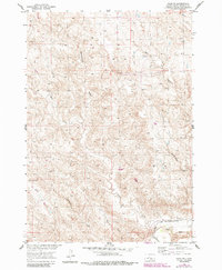
Murray Butte rises as a prominent landmark in this mid-century survey of Stanley County, where the high plains are deeply etched by a complex drainage network. The Bad River flows along the southern edge of the sheet, its course shadowed by the Chicago and North Western railroad. This map, produced as part of the Department of the Interior's Missouri River Basin development program, provides a detailed look at the rural landscape before modern agricultural shifts or infrastructure changed the character of the terrain.
Find a feature on this map
9 named features on this map. Tap any name to fly to it.
Don’t see what you’re looking for? This feature index may not catch every label — zoom into the map to look around manually.
Map Details
Editions of this 1953 Oahe SW Map
2 editions found
Other maps of this area

1937 · Oahe
USGS Topo · 1:62,500

1951 · Van Metre
USGS Topo · 1:24,000

1953 · Teton
USGS Topo · 1:24,000

1953 · Wendte
USGS Topo · 1:24,000

1953 · Wendte NE
USGS Topo · 1:24,000

1954 · Pierre
USGS Topo · 1:250,000

1958 · Pierre
USGS Topo · 1:250,000
1973 · Willow Creek Butte
USGS Topo · 1:24,000

1980 · Princes Ranch
USGS Topo · 1:25,000
1982 · Doty Ridge
USGS Topo · 1:24,000