
1953 Map of Teton
USGS Topo · Published 1955About this map
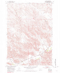
The Bad River carves a winding path across this portion of Stanley County, following the southern corridor where the Chicago and North Western railroad dictates the local geography. In the early 1950s, the small settlement of Teton sits as a lonely rail point near the river's bend, surrounded by a complex network of seasonal drainages including Ash Creek, Stranger Creek, and Powell Creek. The terrain is defined by sharp elevation changes and breaks, most notably at Niggeredge Canyon to the northeast and the curiously named Broken Neck Creek in the southwest. This landscape reflects the ranching and transit patterns of the Missouri River Basin development era, evidenced by isolated landmarks like a Windmill and a small Gravel Pit along the upland sections. The map reveals how the railroad and river dictated early settlement patterns in this semi-arid prairie environment.
Find a feature on this map
12 named features on this map. Tap any name to fly to it.
Don’t see what you’re looking for? This feature index may not catch every label — zoom into the map to look around manually.
Map Details
Editions of this 1953 Teton Map
2 editions found
Other maps of this area

1924 · Pierre
USGS Topo · 1:62,500

1937 · Oahe
USGS Topo · 1:62,500

1953 · Oahe SW
USGS Topo · 1:24,000

1953 · Pierre SW
USGS Topo · 1:24,000

1953 · Wendte
USGS Topo · 1:24,000

1953 · Wendte NE
USGS Topo · 1:24,000

1953 · Pierre 3 NW
USGS Topo · 1:24,000

1954 · Pierre
USGS Topo · 1:250,000

1958 · Pierre
USGS Topo · 1:250,000
1973 · Willow Creek Butte
USGS Topo · 1:24,000