
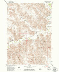
1953 Map of Pierre SW
USGS Topo · Published 1955About this map
Bad River carves a winding path through the rugged Missouri River Basin, dominating the landscape west of Fort Pierre. This mid-century survey illustrates the intricate drainage network of the region, featuring named tributaries such as Willow Creek, Powell Creek, and the uniquely named Gray Blanket Creek. The transport corridor is defined by the Chicago and North Western railroad, which parallels the river's course, connecting the settlement to the broader region.
Find a feature on this map
15 named features on this map. Tap any name to fly to it.
Don’t see what you’re looking for? This feature index may not catch every label — zoom into the map to look around manually.
Map Details
Editions of this 1953 Pierre SW Map
2 editions found
Other maps of this area

1924 · Pierre
USGS Topo · 1:62,500

1937 · Oahe
USGS Topo · 1:62,500

1953 · Teton
USGS Topo · 1:24,000

1953 · Wendte NE
USGS Topo · 1:24,000

1953 · Pierre 3 NW
USGS Topo · 1:24,000

1954 · Pierre
USGS Topo · 1:250,000

1958 · Pierre
USGS Topo · 1:250,000

1967 · Pierre NE
USGS Topo · 1:24,000
1972 · Pierre 3 NE
USGS Topo · 1:24,000
1973 · Pierre
USGS Topo · 1:24,000