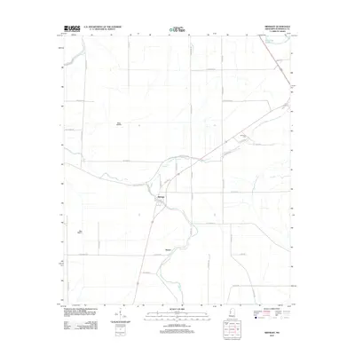
2012 Map of Midnight
USGS Topo · Published 2012About this map
Midnight and the small agricultural communities of Romeo and Bellewood anchor this Delta landscape in Humphreys County. The area is defined by a complex network of water management, where the Sunflower River and Straight Bayou meet engineered drainage features like Main Ditch A and Main Ditch B. These ditches signify the intensive land reclamation efforts required for Mississippi Delta farming. Local history is centered around the Bellewood Cem and the winding course of Silver Cr, which meanders through the central portion of the map. The road network, featuring names like Afro Domino Rd, Po Boy Rd, and Little Abraham Rd, suggests a landscape shaped by local family tracts and historic property lines. In the north, Hard Cash Lake remains a distinct water body amidst the grid of country roads.
Find a feature on this map
47 named features on this map. Tap any name to fly to it.
Don’t see what you’re looking for? This feature index may not catch every label — zoom into the map to look around manually.
Map Details
Editions of this 2012 Midnight Map
This is the sole edition of this map. No revisions or reprints were ever made.
Other maps of this area

1940 · Auter
USGS Topo · 1:62,500

1940 · Mileston
USGS Topo · 1:62,500

1953 · Greenwood
USGS Topo · 1:250,000

1954 · Mileston
USGS Topo · 1:62,500

1955 · Jackson
USGS Topo · 1:250,000

1956 · Greenwood
USGS Topo · 1:250,000

1961 · Jackson
USGS Topo · 1:250,000

1961 · Bayland
USGS Topo · 1:62,500

1961 · Valley
USGS Topo · 1:62,500

1962 · Jackson
USGS Topo · 1:250,000