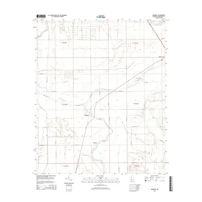
2015 Map of Midnight
USGS Topo · Published 2015About this map
Silver Creek meanders through the heart of the Mississippi Delta, anchoring a landscape defined by its agricultural grid and alluvial hydrology. This 2015 survey reveals the small settlements of Midnight and Romeo, illustrating the persistent rural community structures of Humphreys County. To the northeast, the town of Silver City sits near the winding course of the creek, while the presence of Bellewood Cem near Bellwood provides a localized anchor for genealogical research. The geography is characterized by intricate water systems, including Straight Bayou and the curiously named Hard-Cash Lake, which underscore the region's historical reliance on drainage and proximity to water. Roadways like Afro-Domino Rd and Poor Boy Rd reflect the unique local nomenclature and the deeply patterned land divisions of the Public Land Survey System.
Find a feature on this map
39 named features on this map. Tap any name to fly to it.
Don’t see what you’re looking for? This feature index may not catch every label — zoom into the map to look around manually.
Map Details
Editions of this 2015 Midnight Map
This is the sole edition of this map. No revisions or reprints were ever made.
Other maps of this area

1940 · Auter
USGS Topo · 1:62,500

1940 · Mileston
USGS Topo · 1:62,500

1953 · Greenwood
USGS Topo · 1:250,000

1954 · Mileston
USGS Topo · 1:62,500

1955 · Jackson
USGS Topo · 1:250,000

1956 · Greenwood
USGS Topo · 1:250,000

1961 · Jackson
USGS Topo · 1:250,000

1961 · Bayland
USGS Topo · 1:62,500

1961 · Valley
USGS Topo · 1:62,500

1962 · Jackson
USGS Topo · 1:250,000