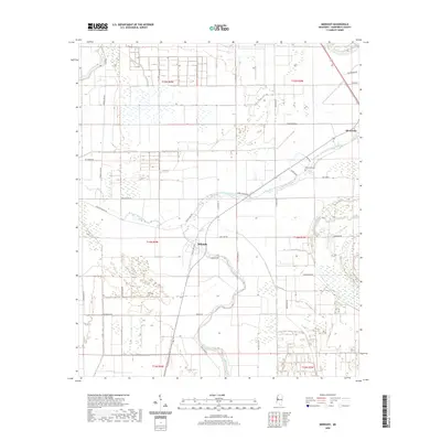
2020 Map of Midnight
USGS Topo · Published 2020About this map
Silver City and the small community of Midnight anchor this Delta landscape in Humphreys County, where the meandering path of Silver Creek defines the local drainage and property lines. The territory is marked by a precise grid of agricultural roads, including evocative local names such as Blue Ruin Rd, Afro Domino Rd, and Peachtree Rd. To the east, the settlement of Bellewood sits near the Bellewood Cem, providing a focal point for genealogical research in this rural corridor. The transition from the old transit ways, represented by Old US Hwy 49W, to modern thoroughfares illustrates the shifting logistics of this cotton-growing region. Water remains a central theme, with Straight Bayou cutting through the western sections, highlighting the low-lying, fertile alluvial plain that has long supported the area's economy.
Find a feature on this map
37 named features on this map. Tap any name to fly to it.
Don’t see what you’re looking for? This feature index may not catch every label — zoom into the map to look around manually.
Map Details
Editions of this 2020 Midnight Map
This is the sole edition of this map. No revisions or reprints were ever made.
Other maps of this area

1940 · Auter
USGS Topo · 1:62,500

1940 · Mileston
USGS Topo · 1:62,500

1953 · Greenwood
USGS Topo · 1:250,000

1954 · Mileston
USGS Topo · 1:62,500

1955 · Jackson
USGS Topo · 1:250,000

1956 · Greenwood
USGS Topo · 1:250,000

1961 · Jackson
USGS Topo · 1:250,000

1961 · Bayland
USGS Topo · 1:62,500

1961 · Valley
USGS Topo · 1:62,500

1962 · Jackson
USGS Topo · 1:250,000