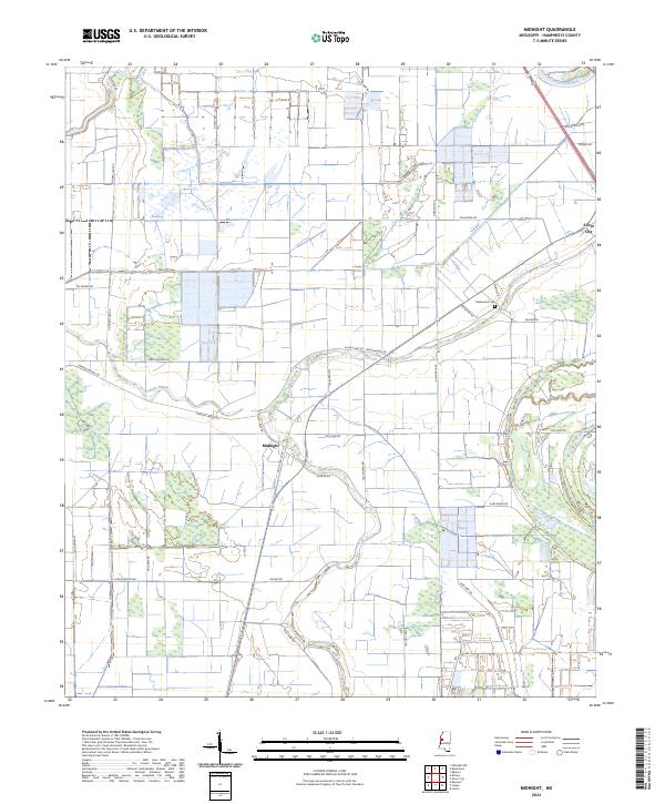
2024 Map of Midnight
USGS Topo · Published 2024About this map
Silver Creek and Little Atchafalaya Bayou define this Humphreys County landscape, where the agricultural geometry of the Mississippi Delta is punctuated by the Theodore Roosevelt National Wildlife Refuge. The settlement of Midnight sits at a crossroads of legacy transport routes, including Old US Hwy 49W, while the community of Silver City occupies the northeastern corner. The map reveals a dense network of local roads with evocative names like Afro Domino Rd, Po Boy Rd, and Blue Ruin Rd, tracing the boundaries of historical land divisions. Genealogy researchers will find the Bellewood Cem near Bellwood, providing a specific point of interest in this predominantly rural region. The interplay between managed wetlands and expansive farm plots illustrates the modern character of these legendary bottomlands.
Find a feature on this map
40 named features on this map. Tap any name to fly to it.
Don’t see what you’re looking for? This feature index may not catch every label — zoom into the map to look around manually.
Map Details
Editions of this 2024 Midnight Map
This is the sole edition of this map. No revisions or reprints were ever made.
Other maps of this area

1940 · Auter
USGS Topo · 1:62,500

1940 · Mileston
USGS Topo · 1:62,500

1953 · Greenwood
USGS Topo · 1:250,000

1954 · Mileston
USGS Topo · 1:62,500

1955 · Jackson
USGS Topo · 1:250,000

1956 · Greenwood
USGS Topo · 1:250,000

1961 · Jackson
USGS Topo · 1:250,000

1961 · Bayland
USGS Topo · 1:62,500

1961 · Valley
USGS Topo · 1:62,500

1962 · Jackson
USGS Topo · 1:250,000