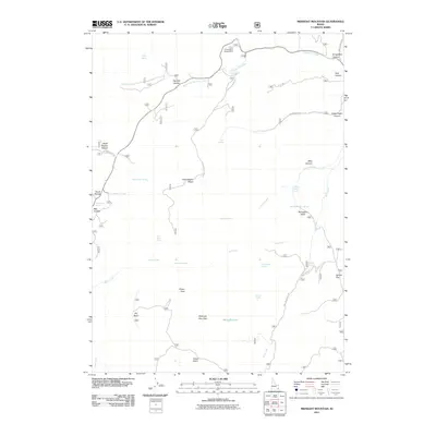
2011 Map of Midnight Mountain
USGS Topo · Published 2011About this map
Midnight Mountain dominates this high-elevation landscape in Franklin County, where the terrain is marked by a complex network of springs and drainages. The map reveals a history of movement and resource use through labels like Emigration Canyon and Relief Society Hollow, suggesting the importance of these mountain corridors to early travelers and local communities. Water is the primary feature of this geography, with numerous named sources such as Hells Kitchen Spring, Mink Creek Spring, and Strawberry Spring feeding into larger systems like Mill Creek and Williams Creek. The presence of the Emigration Campground and several National Forest roads indicates the area's modern role as a recreational destination. Lower elevations like Danish Flat and basins such as Copenhagen Basin and Green Basin provide topographical contrast to the surrounding peaks, while Midnight Lake sits as a high-altitude landmark.
Find a feature on this map
45 named features on this map. Tap any name to fly to it.
Don’t see what you’re looking for? This feature index may not catch every label — zoom into the map to look around manually.
Map Details
Editions of this 2011 Midnight Mountain Map
This is the sole edition of this map. No revisions or reprints were ever made.
Other maps of this area

1909 · Montpelier
USGS Topo · 1:125,000

1911 · Montpelier
USGS Topo · 1:125,000

1915 · Preston
USGS Topo · 1:96,000

1918 · Preston
USGS Topo · 1:125,000

1955 · Preston
USGS Topo · 1:250,000

1958 · Preston
USGS Topo · 1:250,000

1962 · Preston
USGS Topo · 1:250,000

1967 · Paris
USGS Topo · 1:24,000

1967 · Ovid
USGS Topo · 1:24,000
1969 · Midnight Mtn
USGS Topo · 1:24,000