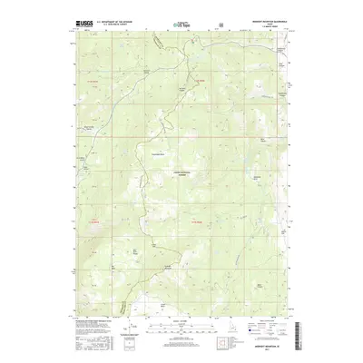
2017 Map of Midnight Mountain
USGS Topo · Published 2017About this map
The Bear River Range dominates this portion of the Cache National Forest, marking a landscape defined by high ridges and deep drainages along the border of Franklin and Bear Lake counties. The presence of Midnight Mountain and the nearby Midnight Lake anchor the southern reaches of the map, while the central Copenhagen Basin serves as a gathering point for numerous seasonal water sources. The terrain is deeply etched with family and community-named landmarks such as Relief Society Hollow, Wills Canyon, and Williams Canyon.
Find a feature on this map
50 named features on this map. Tap any name to fly to it.
Don’t see what you’re looking for? This feature index may not catch every label — zoom into the map to look around manually.
Map Details
Editions of this 2017 Midnight Mountain Map
This is the sole edition of this map. No revisions or reprints were ever made.
Other maps of this area

1909 · Montpelier
USGS Topo · 1:125,000

1911 · Montpelier
USGS Topo · 1:125,000

1915 · Preston
USGS Topo · 1:96,000

1918 · Preston
USGS Topo · 1:125,000

1955 · Preston
USGS Topo · 1:250,000

1958 · Preston
USGS Topo · 1:250,000

1962 · Preston
USGS Topo · 1:250,000

1967 · Paris
USGS Topo · 1:24,000

1967 · Ovid
USGS Topo · 1:24,000
1969 · Midnight Mtn
USGS Topo · 1:24,000