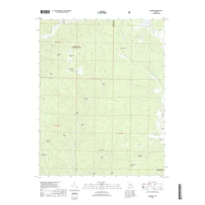
2017 Map of Midridge
USGS Topo · Published 2017About this map
Midridge and Rat sit within the heavily dissected plateau of the Ozarks, surrounded by the extensive lands of the Mark Twain National Forest. The landscape is defined by its complex network of hollows and springs, many bearing the names of early settler families, such as Laxton Hollow, Barton Hollow, and Callahan Hollow. These geographic features suggest a history of localized subsistence and small-scale timber harvesting in the steep terrain of Shannon and Reynolds counties. Notable water sources like McIntire Spring, Alec Spring, and Spout Spring feed into major drainages including Blair Cr and Logan Cr. The presence of landmarks such as Nuckols Cem and Which Church Hollow provides specific points of interest for genealogists tracing the distribution of communities and families across these remote ridges and valleys during the late twentieth century and into the contemporary era.
Find a feature on this map
59 named features on this map. Tap any name to fly to it.
Don’t see what you’re looking for? This feature index may not catch every label — zoom into the map to look around manually.
Map Details
Editions of this 2017 Midridge Map
This is the sole edition of this map. No revisions or reprints were ever made.
Other maps of this area

1915 · Eminence
USGS Topo · 1:62,500

1917 · Eminence
USGS Topo · 1:62,500

1928 · Cardareva
USGS Topo · 1:62,500

1944 · Corridon
USGS Topo · 1:62,500

1945 · Round Spring
USGS Topo · 1:62,500

1947 · Sinkin
USGS Topo · 1:48,000

1947 · Corridon
USGS Topo · 1:62,500

1949 · Round Spring
USGS Topo · 1:62,500

1949 · Rolla
USGS Topo · 1:250,000

1949 · Cardareva
USGS Topo · 1:62,500