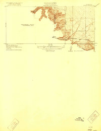
1916 Map of Midway
USGS Topo · Published 1921About this map
The settlement of Midway anchors this 1912 survey, situated at a critical junction of transportation and geography along the Alameda Co San Joaquin Co line. This preliminary edition highlights a landscape in transition, where the intricate topography of the Altamont Pass area meets the valley floor. The map documents the competing infrastructure of the era, showing the parallel routes of the Southern Pacific and the Western Pacific railroads as they navigate the coastal range's eastern slopes.
Find a feature on this map
8 named features on this map. Tap any name to fly to it.
Don’t see what you’re looking for? This feature index may not catch every label — zoom into the map to look around manually.
Map Details
Editions of this 1916 Midway Map
3 editions found
Other maps of this area

1907 · Tesla
USGS Topo · 1:62,500

1911 · Byron Hot Springs
USGS Topo · 1:31,680

1914 · Bethany
USGS Topo · 1:31,680

1914 · Union Island
USGS Topo · 1:31,680

1916 · Byron Hot Springs
USGS Topo · 1:31,680

1916 · Byron
USGS Topo · 1:62,500

1916 · Tracy
USGS Topo · 1:31,680

1916 · Midway
USGS Topo · 1:31,680

1922 · Carbona
USGS Topo · 1:62,500

1940 · Byron
USGS Topo · 1:62,500