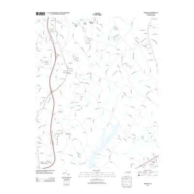
2013 Map of Midway
USGS Topo · Published 2013About this map
Midway and its surrounding residential developments anchor this 2013 survey of the Piedmont landscape south of Winston-Salem. The map reveals a transition from dense suburban clusters like The Oaks, Gum Tree, and Ridgeview Acres in the north to more dispersed rural settlements such as Ebenezer and Bethesda. A complex drainage system of small creeks and branches, including Abbotts Cr, Rich Fork, and Leonard Cr, dissects the terrain, leading toward the significant reservoir of Lake Tom-A-Lex in the south.
Find a feature on this map
257 named features on this map. Tap any name to fly to it.
Don’t see what you’re looking for? This feature index may not catch every label — zoom into the map to look around manually.
Map Details
Editions of this 2013 Midway Map
This is the sole edition of this map. No revisions or reprints were ever made.
Other maps of this area

1949 · Eller
USGS Topo · 1:24,000

1949 · High Point West
USGS Topo · 1:24,000

1950 · Winston-Salem West
USGS Topo · 1:24,000

1950 · Lexington East
USGS Topo · 1:24,000

1950 · Winston-Salem East
USGS Topo · 1:24,000

1950 · Lexington West
USGS Topo · 1:24,000

1951 · Winston-Salem West
USGS Topo · 1:24,000

1951 · Winston-Salem East
USGS Topo · 1:24,000

1951 · Lexington East
USGS Topo · 1:24,000

1951 · Lexington West
USGS Topo · 1:24,000