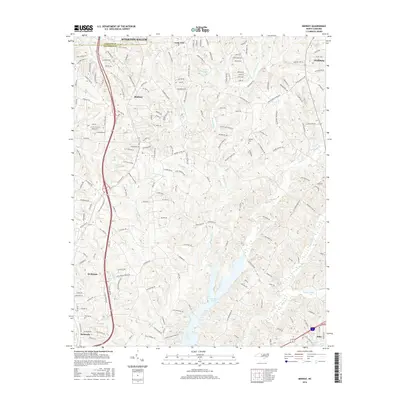
2016 Map of Midway
USGS Topo · Published 2016About this map
Lake Tom-A-Lex sits at the center of this 2016 survey, where the drainages of Brushy Fork and Rich Fork converge. The landscape reflects the transition from the southern outskirts of Winston-Salem in Forsyth County into the rolling countryside of Davidson County. Small, established communities like Midway, Gum Tree, and Wallburg are connected by a network of winding roads such as Hebron Church Rd and Gumtree Rd, which contrast with the modern corridor of Old US Hwy 52. Genealogists may find interest in the location of Bethany Cem and the clusters of homes at Bethesda, Welcome, and Pilot. The map also captures numerous smaller waterways that defined local property lines and land use for generations, including Oil Mill Br, Tinkers Cr, and Buck Br.
Find a feature on this map
193 named features on this map. Tap any name to fly to it.
Don’t see what you’re looking for? This feature index may not catch every label — zoom into the map to look around manually.
Map Details
Editions of this 2016 Midway Map
This is the sole edition of this map. No revisions or reprints were ever made.
Other maps of this area

1949 · Eller
USGS Topo · 1:24,000

1949 · High Point West
USGS Topo · 1:24,000

1950 · Winston-Salem West
USGS Topo · 1:24,000

1950 · Lexington East
USGS Topo · 1:24,000

1950 · Winston-Salem East
USGS Topo · 1:24,000

1950 · Lexington West
USGS Topo · 1:24,000

1951 · Winston-Salem West
USGS Topo · 1:24,000

1951 · Winston-Salem East
USGS Topo · 1:24,000

1951 · Lexington East
USGS Topo · 1:24,000

1951 · Lexington West
USGS Topo · 1:24,000