
1979 Map of Midway Draw East
USGS Topo · Published 1979About this map
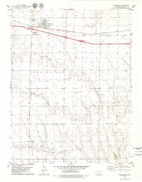
The North Fork Saline River and Saline River converge in this high plains landscape along the border of Sheridan and Gove Counties. The terrain is defined by a series of prominent drainage systems, including Leeds Draw, Turner Draw, and Midway Draw, which carve through the townships of West Saline, East Saline, Payne, and Baker. This 1970s survey documents the rural character of western Kansas, where industrial activity is limited to scattered resource extraction sites such as a Sandpit and an occasional Drill site. The map provides a clear record of the section-line road network and the meandering course of the Saline River before modern agricultural or infrastructure changes altered the local topography.
Find a feature on this map
15 named features on this map. Tap any name to fly to it.
Don’t see what you’re looking for? This feature index may not catch every label — zoom into the map to look around manually.
Map Details
Editions of this 1979 Midway Draw East Map
This is the sole edition of this map. No revisions or reprints were ever made.
Other maps of this area

1954 · Goodland
USGS Topo · 1:250,000

1956 · Goodland
USGS Topo · 1:250,000

1957 · Goodland
USGS Topo · 1:250,000

1979 · Park
USGS Topo · 1:24,000

1979 · Midway Draw West
USGS Topo · 1:24,000
1979 · Grainfield
USGS Topo · 1:24,000

1979 · Hoxie
USGS Topo · 1:24,000

1979 · Tasco
USGS Topo · 1:24,000

1979 · Studley
USGS Topo · 1:24,000
1979 · Quinter NW
USGS Topo · 1:24,000