
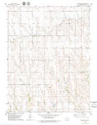
1979 Map of Studley
USGS Topo · Published 1979About this map
The Union Pacific railroad tracks and the winding South Fork Solomon River define the northern corridor of this High Plains landscape, where the settlement of Studley sits at the junction of rail and river. This late 1970s survey illustrates a rural environment transitioning between agricultural tradition and energy extraction, most visible in the Solomon Oil Field and various Oil Wells scattered across the township boundaries of Gettysburg and East Saline. To the northwest, Sheridan State Fishing Lake provides a distinct hydrological landmark fed by North Fork Solomon River. Local social history is anchored in the south by the Mount Pleasant Ch and its adjacent Mount Pleasant Cem, while the drainage patterns of Museum Creek and Rock Creek carve the topography between the Solomon and Saline watersheds.
Find a feature on this map
32 named features on this map. Tap any name to fly to it.
Don’t see what you’re looking for? This feature index may not catch every label — zoom into the map to look around manually.
Map Details
Editions of this 1979 Studley Map
This is the sole edition of this map. No revisions or reprints were ever made.
Other maps of this area

1954 · Goodland
USGS Topo · 1:250,000

1956 · Goodland
USGS Topo · 1:250,000

1957 · Goodland
USGS Topo · 1:250,000

1979 · Lucerne
USGS Topo · 1:24,000

1979 · Midway Draw East
USGS Topo · 1:24,000

1979 · Morland
USGS Topo · 1:24,000

1979 · Hoxie NE
USGS Topo · 1:24,000

1979 · Tasco
USGS Topo · 1:24,000

1979 · St Peter
USGS Topo · 1:24,000
1979 · Morland NE
USGS Topo · 1:24,000