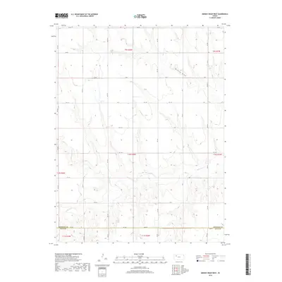
2018 Map of Midway Draw West
USGS Topo · Published 2018About this map
Saline River winds across this rural landscape, carving a low-lying path through the open terrain of the High Plains. Located along the border where Sheridan County meets Gove County, the region is defined by its sectional grid of gravel and dirt roads, including Rd 130 S and Gove EE. These corridors serve as the primary infrastructure for the dispersed agricultural operations and homesteads that characterize western Kansas.
Find a feature on this map
30 named features on this map. Tap any name to fly to it.
Don’t see what you’re looking for? This feature index may not catch every label — zoom into the map to look around manually.
Map Details
Editions of this 2018 Midway Draw West Map
This is the sole edition of this map. No revisions or reprints were ever made.
Other maps of this area

1954 · Goodland
USGS Topo · 1:250,000

1956 · Goodland
USGS Topo · 1:250,000

1957 · Goodland
USGS Topo · 1:250,000

1979 · Park
USGS Topo · 1:24,000

1979 · Midway Draw West
USGS Topo · 1:24,000

1979 · Midway Draw East
USGS Topo · 1:24,000
1979 · Grainfield
USGS Topo · 1:24,000

1979 · Hoxie
USGS Topo · 1:24,000

1979 · Grinnell NE
USGS Topo · 1:24,000
1979 · Sunny Slope Lake
USGS Topo · 1:24,000