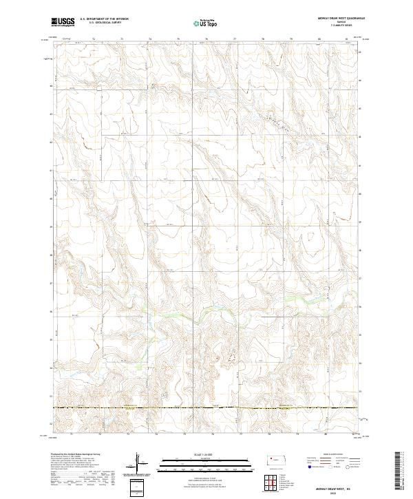
2022 Map of Midway Draw West
USGS Topo · Published 2022About this map
The Saline River winds through the southern reaches of this landscape, carving a distinct path through the plains of western Kansas. This survey reveals a highly organized township and range system, where the terrain is segmented into precise sections defined by the border between Sheridan and Gove counties. The drainage patterns are dominated by the eponymous Midway Draw in the northeast and Spring Brook Cr to the west, illustrating how seasonal water flow has shaped the local topography. This map documents a sparsely populated agricultural environment in the early 21st century, where human presence is primarily marked by a rigid grid of rural roads such as Rd 160 S and Rd 80 S. This infrastructure reflects a long-standing commitment to land management and transportation across the vast interior of the High Plains.
Find a feature on this map
28 named features on this map. Tap any name to fly to it.
Don’t see what you’re looking for? This feature index may not catch every label — zoom into the map to look around manually.
Map Details
Editions of this 2022 Midway Draw West Map
This is the sole edition of this map. No revisions or reprints were ever made.
Other maps of this area

1954 · Goodland
USGS Topo · 1:250,000

1956 · Goodland
USGS Topo · 1:250,000

1957 · Goodland
USGS Topo · 1:250,000

1979 · Park
USGS Topo · 1:24,000

1979 · Midway Draw West
USGS Topo · 1:24,000

1979 · Midway Draw East
USGS Topo · 1:24,000
1979 · Grainfield
USGS Topo · 1:24,000

1979 · Hoxie
USGS Topo · 1:24,000

1979 · Grinnell NE
USGS Topo · 1:24,000
1979 · Sunny Slope Lake
USGS Topo · 1:24,000