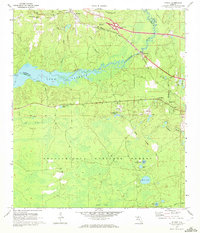
1969 Map of Midway
USGS Topo · Published 1972About this map
The Ochlockonee River flows through this North Florida landscape, dividing Gadsden and Leon counties as it enters the wide expanse of Lake Talquin. To the north, the town of Midway is a focal point of transit where the Seaboard Coast Line railroad and local roads intersect. The map documents a rural community defined by its spiritual and agricultural hubs, including Bethel Ch, Ebenezer Ch, and St Matthews Ch.
Find a feature on this map
46 named features on this map. Tap any name to fly to it.
Don’t see what you’re looking for? This feature index may not catch every label — zoom into the map to look around manually.
Map Details
Editions of this 1969 Midway Map
2 editions found
Other maps of this area

1940 · Tallahassee
USGS Topo · 1:62,500

1942 · Tallahassee
USGS Topo · 1:62,500

1943 · Tallahassee
USGS Topo · 1:62,500

1943 · Lake Talquin
USGS Topo · 1:62,500

1954 · Tallahassee
USGS Topo · 1:250,000

1959 · Tallahassee
USGS Topo · 1:250,000

1959 · Quincy
USGS Topo · 1:24,000

1960 · Tallahassee
USGS Topo · 1:250,000

1963 · Lake Jackson
USGS Topo · 1:24,000
1963 · Havana South
USGS Topo · 1:24,000