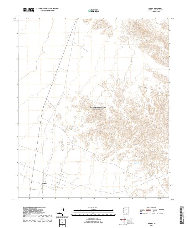
2021 Map of Midway
USGS Topo · Published 2021About this map
The settlement of Midway sits at a crossroads of transport and desert terrain in this modern survey of southwestern Arizona. Dominated by the rugged topography of the Sauceda Mountains, the landscape transitions from the flat plains of the Sonoran desert to the steep elevations of Lookout Mtn. These peaks provide a stark backdrop to the essential water management features of the arid region, such as the Thanksgiving Day Tank located in the southeastern quadrant. The map detail highlights the sparse but vital human footprint across this vast township system, showing the precise coordination of section lines and road networks that connect this remote corner of Maricopa County to the broader region.
Find a feature on this map
8 named features on this map. Tap any name to fly to it.
Don’t see what you’re looking for? This feature index may not catch every label — zoom into the map to look around manually.
Map Details
Editions of this 2021 Midway Map
This is the sole edition of this map. No revisions or reprints were ever made.
Other maps of this area

1950 · Theba
USGS Topo · 1:62,500

1951 · Gila Bend
USGS Topo · 1:62,500

1951 · Theba
USGS Topo · 1:62,500

1953 · Ajo
USGS Topo · 1:250,000

1957 · Ajo
USGS Topo · 1:250,000

1958 · Ajo
USGS Topo · 1:250,000

1958 · Midway
USGS Topo · 1:62,500

1958 · Hat Mountain
USGS Topo · 1:62,500

1962 · Ajo
USGS Topo · 1:250,000

1963 · Ajo
USGS Topo · 1:250,000