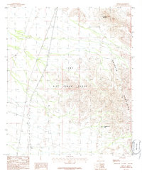
1986 Map of Midway
USGS Topo · Published 1986About this map
Luke Air Force Range dominates this landscape in the mid-1980s, reflecting the significant military footprint in the Arizona desert. The map captures a transition from the level terrain in the west, marked by a prominent north-south Pipeline, to the sharp elevations of the Sauceda Mountains in the east. Among these peaks, Lookout Mountain stands as a primary landmark. Sparse water resources are noted by features like Thanksgiving Day Tank, essential for survival in this arid environment. The small settlement of Midway appears in the southwest corner, while various 4wd tracks crisscross the range, indicating the limited but necessary transport network required for range maintenance and access to this remote interior of Maricopa County.
Find a feature on this map
8 named features on this map. Tap any name to fly to it.
Don’t see what you’re looking for? This feature index may not catch every label — zoom into the map to look around manually.
Map Details
Editions of this 1986 Midway Map
This is the sole edition of this map. No revisions or reprints were ever made.
Other maps of this area

1950 · Theba
USGS Topo · 1:62,500

1951 · Gila Bend
USGS Topo · 1:62,500

1951 · Theba
USGS Topo · 1:62,500

1953 · Ajo
USGS Topo · 1:250,000

1957 · Ajo
USGS Topo · 1:250,000

1958 · Ajo
USGS Topo · 1:250,000

1958 · Midway
USGS Topo · 1:62,500

1958 · Hat Mountain
USGS Topo · 1:62,500

1962 · Ajo
USGS Topo · 1:250,000

1963 · Ajo
USGS Topo · 1:250,000