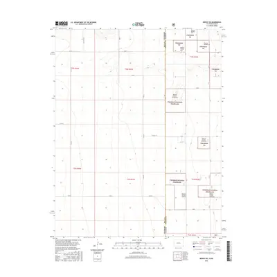
2016 Map of Midway NE
USGS Topo · Published 2016About this map
Cimarron National Grassland dominates the eastern half of this landscape, marking the transition from Colorado into Kansas. This 2016 survey documents the sprawling public lands along the border of Baca County and Morton County, defined by a rigid grid of range roads including Co Rd 56 and Co Rd 53. The map detail reveals a specialized land management system within the Cimarron NG, where large tracts are organized into numbered grazing units such as Pasture Number Fortyseven, Pasture Number Seventeen, and Pasture Number Eighteen. The terrain is characterized by subtle elevation changes and dry drainage patterns that cross the state line near R Blvd and L Blvd. For researchers and historians, this map provides a clear picture of modern rangeland organization and the enduring township-and-range surveying system that still dictates the geography of the High Plains.
Find a feature on this map
30 named features on this map. Tap any name to fly to it.
Don’t see what you’re looking for? This feature index may not catch every label — zoom into the map to look around manually.
Map Details
Editions of this 2016 Midway NE Map
This is the sole edition of this map. No revisions or reprints were ever made.
Other maps of this area

1892 · Vilas
USGS Topo · 1:125,000

1955 · La Junta
USGS Topo · 1:250,000

1955 · Dodge City
USGS Topo · 1:250,000

1958 · La Junta
USGS Topo · 1:250,000

1958 · Dodge City
USGS Topo · 1:250,000

1959 · Dodge City
USGS Topo · 1:250,000

1968 · La Junta
USGS Topo · 1:250,000
1973 · Elkhart North
USGS Topo · 1:24,000
1973 · Richfield SW
USGS Topo · 1:24,000
1973 · Elkhart NW
USGS Topo · 1:24,000