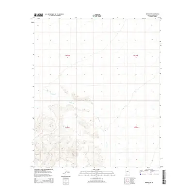
2014 Map of Midway NW
USGS Topo · Published 2014About this map
Crater Range dominates the southwestern corner of this Maricopa County landscape, its steep contours rising sharply from the surrounding desert floor. The topography is defined by the ephemeral drainage of Midway Wash, which cuts diagonally across the central sections of the survey. In an arid region where water management is vital, the presence of Black Tank suggests a specific point of historical or livestock utility within the local drainage system. The map is primarily organized by the Public Land Survey System, showing the intersection of four distinct townships including t8s r7w and t9s r6w. This 2014 edition provides a clear record of the undisturbed desert terrain and the natural watercourses that define the Maricopa backcountry.
Find a feature on this map
7 named features on this map. Tap any name to fly to it.
Don’t see what you’re looking for? This feature index may not catch every label — zoom into the map to look around manually.
Map Details
Editions of this 2014 Midway NW Map
This is the sole edition of this map. No revisions or reprints were ever made.
Other maps of this area

1949 · Sentinel
USGS Topo · 1:62,500

1950 · Sentinel
USGS Topo · 1:62,500

1950 · Theba
USGS Topo · 1:62,500

1951 · Theba
USGS Topo · 1:62,500

1953 · Ajo
USGS Topo · 1:250,000

1957 · Ajo
USGS Topo · 1:250,000

1958 · Ajo
USGS Topo · 1:250,000

1958 · Midway
USGS Topo · 1:62,500

1962 · Ajo
USGS Topo · 1:250,000

1963 · Ajo
USGS Topo · 1:250,000