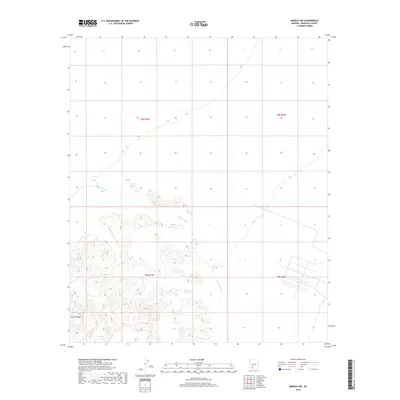
2018 Map of Midway NW
USGS Topo · Published 2018About this map
The Crater Range dominates the southern landscape of this Arizona quadrangle, where the terrain transitions from steep rocky elevations to the broad desert floor. Cutting across the center and northern portions of the map, Midway Wash defines the drainage patterns of this arid region, showing the characteristic seasonal hydrology of the Sonoran Desert. The map reveals a stark contrast between the natural topography and the rigid geometry of the Public Land Survey System, including sections of t8s r7w and t9s r6w. A distinct grid of local roads in the southeast corner provides evidence of land development or desert subdivision planning, standing in isolation against the otherwise open terrain.
Find a feature on this map
6 named features on this map. Tap any name to fly to it.
Don’t see what you’re looking for? This feature index may not catch every label — zoom into the map to look around manually.
Map Details
Editions of this 2018 Midway NW Map
This is the sole edition of this map. No revisions or reprints were ever made.
Other maps of this area

1949 · Sentinel
USGS Topo · 1:62,500

1950 · Sentinel
USGS Topo · 1:62,500

1950 · Theba
USGS Topo · 1:62,500

1951 · Theba
USGS Topo · 1:62,500

1953 · Ajo
USGS Topo · 1:250,000

1957 · Ajo
USGS Topo · 1:250,000

1958 · Ajo
USGS Topo · 1:250,000

1958 · Midway
USGS Topo · 1:62,500

1962 · Ajo
USGS Topo · 1:250,000

1963 · Ajo
USGS Topo · 1:250,000