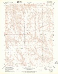
1978 Map of Midway
USGS Topo · Published 1979About this map
Midway serves as the central point for this section of Rawlins County, Kansas, where the high plains landscape is defined by the townships of Herndon, Union, and Laing. The map reveals a deeply rooted immigrant history through its religious and funerary landmarks, specifically documenting the Swedish Baptist Cem, Swedish Lutheran Cem, and the Mission Covenant Ch. These sites, along with the Covenant Cem, suggest a community structure built around distinct denominational clusters in the late 1970s. The terrain is characterized by the drainage of Lambs Draw and several intermittent water sources like Spring. While agriculture remains the primary footprint, the presence of an Oil Well and other wells indicates the diversification of the local economy into resource extraction.
Find a feature on this map
14 named features on this map. Tap any name to fly to it.
Don’t see what you’re looking for? This feature index may not catch every label — zoom into the map to look around manually.
Map Details
Editions of this 1978 Midway Map
This is the sole edition of this map. No revisions or reprints were ever made.
Other maps of this area

1951 · Selden
USGS Topo · 1:62,500

1951 · Herndon
USGS Topo · 1:62,500

1951 · Achilles
USGS Topo · 1:62,500

1951 · Oberlin
USGS Topo · 1:62,500

1954 · Goodland
USGS Topo · 1:250,000

1956 · Goodland
USGS Topo · 1:250,000

1957 · Goodland
USGS Topo · 1:250,000

1965 · Oberlin SW
USGS Topo · 1:24,000

1965 · Achilles
USGS Topo · 1:24,000

1965 · Selden NW
USGS Topo · 1:24,000