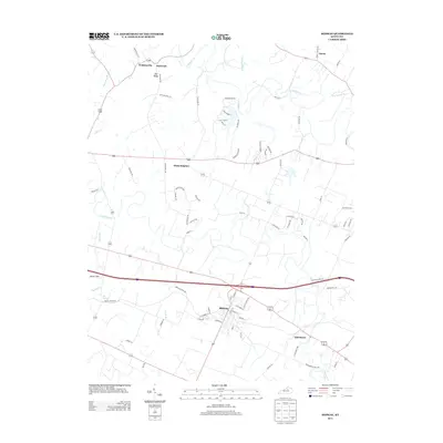
2013 Map of Midway
USGS Topo · Published 2013About this map
Midway stands as the central hub of this Woodford County landscape, where the surrounding terrain is defined by the intricate branching of N Elkhorn Cr and S Elkhorn Cr. The settlement pattern reflects a deeply rooted community, with older named locations such as White Sulphur and Davistown situated near the rolling drainage of Coles Br and Lee Br. The geological character of the region is punctuated by Simms Sink and the reliable water source of Big Spring, illustrating the karst-influenced topography typical of the Bluegrass region. Further north, smaller clusters like Watkinsville and Sand Lick are connected by a network of established thoroughfares like Pea Ridge Rd and Watkinsville Ln, tracing the early rural development of the area between McConnell Run and Buck Run.
Find a feature on this map
79 named features on this map. Tap any name to fly to it.
Don’t see what you’re looking for? This feature index may not catch every label — zoom into the map to look around manually.
Map Details
Editions of this 2013 Midway Map
This is the sole edition of this map. No revisions or reprints were ever made.
Other maps of this area

1906 · Lockport
USGS Topo · 1:48,000

1906 · Georgetown
USGS Topo · 1:62,500

1908 · Lockport
USGS Topo · 1:62,500

1908 · Georgetown
USGS Topo · 1:62,500

1922 · Frankfort
USGS Topo · 1:48,000

1924 · Frankfort
USGS Topo · 1:62,500

1939 · Sadieville
USGS Topo · 1:62,500

1950 · Lexington West
USGS Topo · 1:24,000

1952 · Midway
USGS Topo · 1:24,000
1953 · Stamping Ground
USGS Topo · 1:24,000