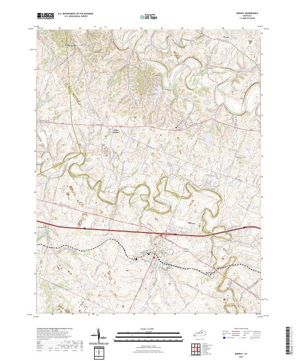
2022 Map of Midway
USGS Topo · Published 2022About this map
Midway serves as a central hub on this map of the Kentucky Bluegrass region, where the intersection of historic land divisions and modern development is clearly visible. The landscape is defined by the winding paths of North Elkhorn Creek and South Elkhorn Creek, which carve through the undulating terrain of Woodford and Scott counties. Settlement patterns are dense with genealogy-rich landmarks, particularly the Sons and Daughters of Relief Cem and the Midway Cem, alongside the campus of Midway University.
Find a feature on this map
86 named features on this map. Tap any name to fly to it.
Don’t see what you’re looking for? This feature index may not catch every label — zoom into the map to look around manually.
Map Details
Editions of this 2022 Midway Map
This is the sole edition of this map. No revisions or reprints were ever made.
Other maps of this area

1906 · Lockport
USGS Topo · 1:48,000

1906 · Georgetown
USGS Topo · 1:62,500

1908 · Lockport
USGS Topo · 1:62,500

1908 · Georgetown
USGS Topo · 1:62,500

1922 · Frankfort
USGS Topo · 1:48,000

1924 · Frankfort
USGS Topo · 1:62,500

1939 · Sadieville
USGS Topo · 1:62,500

1950 · Lexington West
USGS Topo · 1:24,000

1952 · Midway
USGS Topo · 1:24,000
1953 · Stamping Ground
USGS Topo · 1:24,000