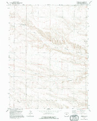
1991 Map of Midway SE
USGS Topo · Published 1995About this map
Pleasantview Ch stands as a spiritual landmark in this corner of Laramie County, appearing on a landscape characterized by deep drainages and cattle country. The terrain is defined by the significant path of Chivington Draw, which winds through the northern portion of the map, and Antelope Draw further south. These seasonal watercourses and the presence of Spring Creek suggest a long history of ranching and land use dependent on the natural flow of the High Plains. While largely a rural landscape, the inclusion of a Gravel Pit indicates local industry related to road maintenance or construction in this high prairie environment. The survey reflects a continuity of land boundaries and natural features maintained since the mid-20th century.
Find a feature on this map
5 named features on this map. Tap any name to fly to it.
Don’t see what you’re looking for? This feature index may not catch every label — zoom into the map to look around manually.
Map Details
Editions of this 1991 Midway SE Map
This is the sole edition of this map. No revisions or reprints were ever made.
Other maps of this area

1954 · Cheyenne
USGS Topo · 1:250,000

1958 · Cheyenne
USGS Topo · 1:250,000

1963 · Burns
USGS Topo · 1:24,000

1963 · Midway
USGS Topo · 1:24,000

1963 · Midway SE
USGS Topo · 1:24,000
1963 · Round Top
USGS Topo · 1:24,000

1963 · Midway SW
USGS Topo · 1:24,000
1963 · Hillsdale
USGS Topo · 1:24,000

1963 · Gurney Peak
USGS Topo · 1:24,000

1963 · Tracy
USGS Topo · 1:24,000