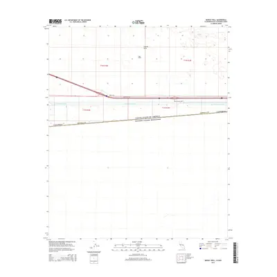
2015 Map of Midway Well
USGS Topo · Published 2015About this map
The international boundary between the United States of America and Estados Unidos Mexicanos defines the southern portion of this desert landscape. This 2015 study illustrates a vital corridor of infrastructure where the All-American Canal carries water across the East Mesa of the Imperial Valley. The map focuses on the transit artery of the Evan Hewes Hwy, which parallels the canal and passes through the remote outpost of Midway Well. Local engineering and access are further noted by the presence of the Brock Research Ovps. The stark contrast between the desert terrain and the massive irrigation project demonstrates the 21st-century management of the border region's hydraulic and transportation networks.
Find a feature on this map
13 named features on this map. Tap any name to fly to it.
Don’t see what you’re looking for? This feature index may not catch every label — zoom into the map to look around manually.
Map Details
Editions of this 2015 Midway Well Map
This is the sole edition of this map. No revisions or reprints were ever made.
Other maps of this area

1903 · Yuma
USGS Topo · 1:125,000

1905 · Yuma
USGS Topo · 1:125,000

1907 · Holtville
USGS Topo · 1:125,000

1942 · El Centro
USGS Topo · 1:250,000

1942 · Yuma
USGS Topo · 1:250,000

1953 · Grays Well
USGS Topo · 1:24,000

1953 · Ogilby
USGS Topo · 1:62,500

1953 · Cactus
USGS Topo · 1:24,000

1954 · El Centro
USGS Topo · 1:250,000

1954 · Midway Well NW
USGS Topo · 1:24,000