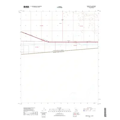
2018 Map of Midway Well
USGS Topo · Published 2018About this map
East Mesa and the eastern edge of the Imperial Valley define this desert landscape along the international boundary between the United States and Mexico. The map centers on the critical water infrastructure of the All American Canal, which courses through the arid terrain parallel to the border. The small settlement at Midway Well serves as a lonely landmark along the Evan Hewes Hwy, which cuts across the survey as the primary transport artery. This 2018 edition illustrates the stark geometry of the desert, where straight-line township and range boundaries like t16s r18e and t17s r19e impose order on the open expanse of the California-Mexico borderlands.
Find a feature on this map
10 named features on this map. Tap any name to fly to it.
Don’t see what you’re looking for? This feature index may not catch every label — zoom into the map to look around manually.
Map Details
Editions of this 2018 Midway Well Map
This is the sole edition of this map. No revisions or reprints were ever made.
Other maps of this area

1903 · Yuma
USGS Topo · 1:125,000

1905 · Yuma
USGS Topo · 1:125,000

1907 · Holtville
USGS Topo · 1:125,000

1942 · El Centro
USGS Topo · 1:250,000

1942 · Yuma
USGS Topo · 1:250,000

1953 · Grays Well
USGS Topo · 1:24,000

1953 · Ogilby
USGS Topo · 1:62,500

1953 · Cactus
USGS Topo · 1:24,000

1954 · El Centro
USGS Topo · 1:250,000

1954 · Midway Well NW
USGS Topo · 1:24,000