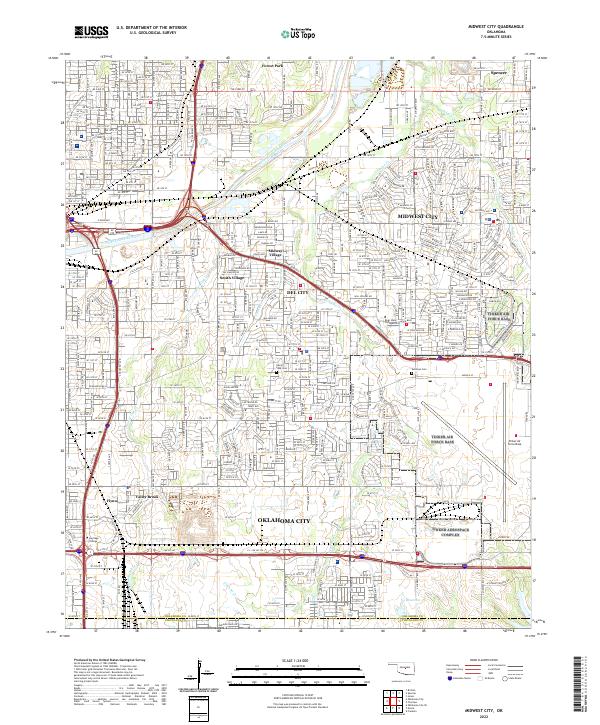
2022 Map of Midwest City
USGS Topo · Published 2022About this map
Midwest City and Del City anchor this modern landscape just east of the state capital, showing the dense suburban development and infrastructure of the early 2020s. The southeastern corner is dominated by the sprawling footprint of Tinker Air Force Base, a critical local employment and aviation hub. This map captures the intricate drainage patterns of the North Canadian River and its tributaries, including Crutcho Cr and Crooked Oak Cr, which weave through residential neighborhoods and industrial zones. Smaller incorporated enclaves like Smith-Village and Midway Village appear as distinct jurisdictions within the larger metropolitan area. Local landmarks such as Rose State College and long-standing sites like Sunny Lane Cem provide important points of reference for genealogists and local historians tracking the growth of these central Oklahoma communities.
Find a feature on this map
349 named features on this map. Tap any name to fly to it.
Don’t see what you’re looking for? This feature index may not catch every label — zoom into the map to look around manually.
Map Details
Editions of this 2022 Midwest City Map
This is the sole edition of this map. No revisions or reprints were ever made.
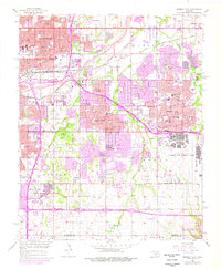
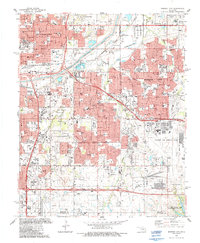
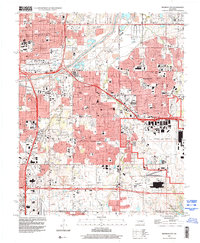
Historical Maps of Forest Park Through Time
4 maps found