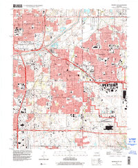
1995 Map of Midwest City
USGS Topo · Published 2000About this map
The North Canadian River cuts across the northern landscape, anchoring a sprawling urban corridor that connects Oklahoma City to the neighboring municipalities of Midwest City and Del City. The mid-1990s development is defined by major infrastructure, with the vast expanse of Tinker Air Force Base occupying the southeastern quadrant and a complex network of levees and aqueducts managing the local water flow.
Find a feature on this map
71 named features on this map. Tap any name to fly to it.
Don’t see what you’re looking for? This feature index may not catch every label — zoom into the map to look around manually.
Map Details
Editions of this 1995 Midwest City Map
This is the sole edition of this map. No revisions or reprints were ever made.
Other maps of this area

1892 · Moore
USGS Topo · 1:62,500

1892 · Edmond
USGS Topo · 1:62,500

1892 · Kingfisher
USGS Topo · 1:125,000

1893 · Oklahoma City
USGS Topo · 1:62,500

1895 · Kingfisher
USGS Topo · 1:125,000

1898 · Purcell
USGS Topo · 1:125,000

1904 · Chickasha
USGS Topo · 1:125,000

1934 · Crutcho Creek
USGS Topo · 1:24,000

1934 · Moore
USGS Topo · 1:62,500

1935 · Spencer
USGS Topo · 1:24,000