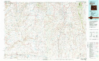
1981 Map of Midwest
USGS Topo · Published 1981About this map
The Salt Creek Oil Field and the adjacent Naval Petroleum Reserve No 3 dominate this Wyoming landscape, reflecting the intensive energy development of the late twentieth century. Centered on the town of Midwest and nearby Edgerton, the map illustrates a complex network of resource extraction roads and pipelines characteristic of the High Plains energy boom. The drainage of Salt Creek and Teapot Creek carves through the terrain, punctuated by geologic landmarks like the distinctive Teapot Rock and Devils Monument.
Find a feature on this map
47 named features on this map. Tap any name to fly to it.
Don’t see what you’re looking for? This feature index may not catch every label — zoom into the map to look around manually.
Map Details
Editions of this 1981 Midwest Map
This is the sole edition of this map. No revisions or reprints were ever made.
Other maps of this area

1949 · Campbell Hill
USGS Topo · 1:24,000

1949 · Glenrock NW
USGS Topo · 1:24,000

1949 · Pratts Soda Lakes
USGS Topo · 1:24,000

1950 · Campbell Hill
USGS Topo · 1:24,000

1950 · Glenrock NW
USGS Topo · 1:24,000

1950 · Pratts Soda Lakes
USGS Topo · 1:24,000

1950 · Emigrant Gap NE
USGS Topo · 1:24,000

1951 · The Reefs
USGS Topo · 1:24,000

1951 · Emigrant Gap NW
USGS Topo · 1:24,000

1951 · Square Top Butte
USGS Topo · 1:24,000