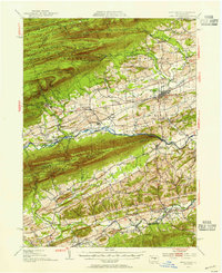
1953 Map of Mifflinburg
USGS Topo · Published 1955About this map
Mifflinburg serves as a primary hub within this mid-century landscape, situated north of the prominent ridge lines of the Bald Eagle State Forest and the Penn Mountain State Forest. The map documents the rural character of the Union and Snyder county border, where small settlements like Centerville and Laurelton are connected by the valley of Penn Creek. The presence of the Laurelton State Village and various local landmarks such as the Church of the Brethren and St Peters Ch reflect the community infrastructure of the early 1950s. To the south, Middleburg and Swineford anchor the valley along Middle Creek, surrounded by numerous family and community cemeteries like Long Cem and the Hassinger Sch Cem, which provide significant value for genealogical research. The terrain is defined by dramatic ridges including Jacks Mountain and Shade Mountain, separated by narrows and gaps that dictated the path of early roads and rail lines.
Find a feature on this map
99 named features on this map. Tap any name to fly to it.
Don’t see what you’re looking for? This feature index may not catch every label — zoom into the map to look around manually.
Map Details
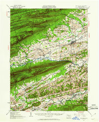
Editions of this 1953 Mifflinburg Map
2 editions found
Other maps of this area

1893 · Sunbury
USGS Topo · 1:62,500

1893 · Millersburg
USGS Topo · 1:62,500

1907 · Millerstown
USGS Topo · 1:62,500

1921 · Williamsport
USGS Topo · 1:48,000

1921 · Lock Haven
USGS Topo · 1:62,500

1923 · Lock Haven
USGS Topo · 1:62,500

1923 · Williamsport
USGS Topo · 1:62,500

1924 · Milton
USGS Topo · 1:62,500

1925 · Mifflintown
USGS Topo · 1:48,000

1934 · Mifflintown
USGS Topo · 1:62,500