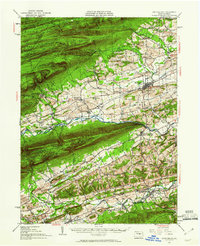
1953 Map of Mifflinburg
USGS Topo · Published 1960About this map
Mifflinburg and the surrounding agricultural valleys of Central Pennsylvania are captured here at mid-century, bounded by the steep forested ridges of Bald Eagle State Forest and Penn State Forest. The landscape is a corridor of small settlements and rural infrastructure, where the Pennsylvania Railroad tracks link towns like Millmont and Swineford. The map reveals a dense network of local landmarks, including several country schools like Red Bank Sch and Burger Sch, and social centers such as Rock Oak Park.
Find a feature on this map
104 named features on this map. Tap any name to fly to it.
Don’t see what you’re looking for? This feature index may not catch every label — zoom into the map to look around manually.
Map Details
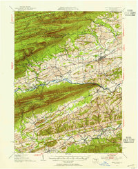
Editions of this 1953 Mifflinburg Map
2 editions found
Other maps of this area

1893 · Sunbury
USGS Topo · 1:62,500

1893 · Millersburg
USGS Topo · 1:62,500

1907 · Millerstown
USGS Topo · 1:62,500

1921 · Williamsport
USGS Topo · 1:48,000

1921 · Lock Haven
USGS Topo · 1:62,500

1923 · Lock Haven
USGS Topo · 1:62,500

1923 · Williamsport
USGS Topo · 1:62,500

1924 · Milton
USGS Topo · 1:62,500

1925 · Mifflintown
USGS Topo · 1:48,000

1934 · Mifflintown
USGS Topo · 1:62,500