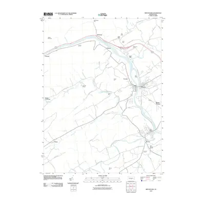
2010 Map of Mifflintown
USGS Topo · Published 2010About this map
The Juniata River carves a central path through this section of central Pennsylvania, dictating the development of riverside settlements like Mifflintown and Port Royal. In the northern reach, the river squeezes through the Macedonia Gap between Shade Mountain and Arch Rock, where transportation corridors like Old Route 22 and the William Penn Hwy converge. This 2010 survey highlights the rural-industrial character of the landscape, noting landmarks such as Zooks Dam and the Mifflintown Airport. Genealogy researchers will find several well-defined burial sites, including Union Cemetery and Church Hill Cemetery, which serve as anchors for the local community history. To the south, the terrain opens into valleys fed by Tuscarora Creek and Markee Creek, where smaller hamlets like Walnut and Old Port sit amidst a network of winding county roads like Groninger Valley Rd.
Find a feature on this map
63 named features on this map. Tap any name to fly to it.
Don’t see what you’re looking for? This feature index may not catch every label — zoom into the map to look around manually.
Map Details
Editions of this 2010 Mifflintown Map
This is the sole edition of this map. No revisions or reprints were ever made.
Other maps of this area

1919 · Mattawana
USGS Topo · 1:62,500

1924 · Lewistown
USGS Topo · 1:62,500

1925 · Mifflintown
USGS Topo · 1:48,000

1927 · Lewisburg
USGS Topo · 1:62,500

1930 · Loysville
USGS Topo · 1:62,500

1933 · Loysville
USGS Topo · 1:62,500

1934 · Mifflintown
USGS Topo · 1:62,500

1936 · East Waterford
USGS Topo · 1:48,000

1937 · Mifflintown
USGS Topo · 1:62,500

1941 · East Waterford
USGS Topo · 1:62,500