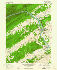
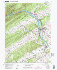
1959 Map of Mifflintown
USGS Topo · Published 1960About this map
The Juniata River carves a deep path through the ridge-and-valley landscape of Juniata County, where the sister boroughs of Mifflintown and Mifflin face one another across the water. By the late 1950s, this corridor was a focal point of transport and industry, defined by the Pennsylvania railroad line and the William Penn Highway. The map reveals a transition between concentrated town life and the surrounding agricultural valleys, where local landmarks like Cuba Mills and Rockville sit in the shadow of Shade Mountain.
Find a feature on this map
65 named features on this map. Tap any name to fly to it.
Don’t see what you’re looking for? This feature index may not catch every label — zoom into the map to look around manually.
Map Details
Editions of this 1959 Mifflintown Map
5 editions found
Other maps of this area

1919 · Mattawana
USGS Topo · 1:62,500

1924 · Lewistown
USGS Topo · 1:62,500

1925 · Mifflintown
USGS Topo · 1:48,000

1927 · Lewisburg
USGS Topo · 1:62,500

1930 · Loysville
USGS Topo · 1:62,500

1933 · Loysville
USGS Topo · 1:62,500

1934 · Mifflintown
USGS Topo · 1:62,500

1936 · East Waterford
USGS Topo · 1:48,000

1937 · Mifflintown
USGS Topo · 1:62,500

1941 · East Waterford
USGS Topo · 1:62,500