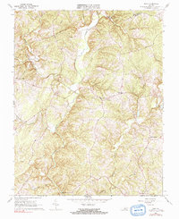
1966 Map of Mike
USGS Topo · Published 1991About this map
The Falling River and its many tributaries, including Little Falling River, carve a dense network of valleys across this rural Campbell County landscape. Settled communities and community centers are anchored by local institutions such as Morris Church, New Bethel Ch, and the Falling River Sch. The terrain is defined by the prominent Red Oak Mountain in the northwest, while the southeastern portions are marked by smaller ridges like Gravel Ridge. This mid-century view shows a landscape of scattered rural residences and farmsteads connected by winding roads and several jeep trails, predating major modern suburban development. Along the creek beds and branches, such as Rattlesnake Creek and Mollys Creek, the map traces the traditional drainage patterns that dictated the placement of early settlements like Spring Mills and the small crossroads of Mike.
Find a feature on this map
29 named features on this map. Tap any name to fly to it.
Don’t see what you’re looking for? This feature index may not catch every label — zoom into the map to look around manually.
Map Details
Editions of this 1966 Mike Map
2 editions found
Other maps of this area

1892 · Lynchburg
USGS Topo · 1:125,000

1892 · Appomattox
USGS Topo · 1:125,000

1944 · Lynchburg
USGS Topo · 1:62,500

1947 · Roanoke
USGS Topo · 1:250,000

1950 · Lynchburg
USGS Topo · 1:62,500

1956 · Brookneal
USGS Topo · 1:62,500

1956 · Gladys
USGS Topo · 1:62,500

1958 · Appomattox
USGS Topo · 1:62,500

1959 · Roanoke
USGS Topo · 1:250,000

1963 · Roanoke
USGS Topo · 1:250,000