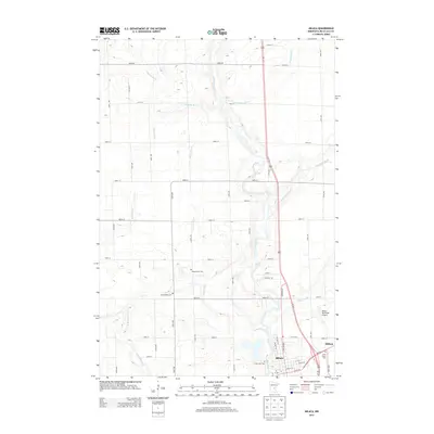
2013 Map of Milaca
USGS Topo · Published 2013About this map
Milaca serves as the focal point of this northern Minnesota landscape, situated where the Rum River meanders southward to meet the W Br Rum River. The township's agricultural character is defined by a dense grid of numbered roads and avenues, with waterways like Tibbetts Brook and Whitney Brook carving natural paths across the surveyed sections. This 2013 record documents the town's modern infrastructure, including the Milaca Municipal Airport and the expansion along Central Ave. For local historians and genealogists, the map identifies significant burial sites including Chase Brook Cem, Forest Hill Cem, and Saint Marys Cem. The drainage patterns of smaller streams such as Mike Drew Brook and O'Neill Brook highlight the subtle hydrology that has influenced local land use and development for generations.
Find a feature on this map
46 named features on this map. Tap any name to fly to it.
Don’t see what you’re looking for? This feature index may not catch every label — zoom into the map to look around manually.
Map Details
Editions of this 2013 Milaca Map
This is the sole edition of this map. No revisions or reprints were ever made.
Other maps of this area

1953 · Stillwater
USGS Topo · 1:250,000

1955 · Stillwater
USGS Topo · 1:250,000

1958 · Stillwater
USGS Topo · 1:250,000

1965 · Stillwater
USGS Topo · 1:250,000

1968 · Ramey NE
USGS Topo · 1:24,000

1968 · Milaca NE
USGS Topo · 1:24,000

1968 · Rum River
USGS Topo · 1:24,000

1968 · Milaca
USGS Topo · 1:24,000
1968 · Page
USGS Topo · 1:24,000
1968 · Ronneby
USGS Topo · 1:24,000