2022 Map of Milaca
USGS Topo · Published 2022About this map
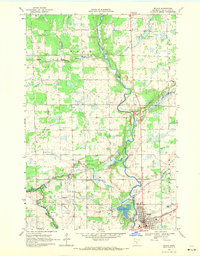
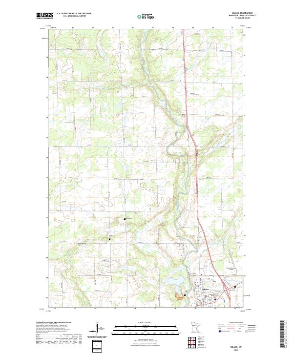
Milaca serves as the focal point of this region, situated along the winding course of the Rum River as it flows south toward the Milaca Municipal Airport. The landscape is defined by a dense network of tributaries including Whitney Brook, Tibbetts Brook, and Stony Brook, which drain the surrounding wetlands and agricultural fields. This modern survey illustrates the proximity of the Mille Lacs County Justice Center to the historical resting places at Forest Hill Cem and the more remote Chase Brook Cem. The transition from rural township sections like t39n r27w to the concentrated street grid of the city reveals how local infrastructure has adapted to the river's path, with routes such as Co Rd 16 and Co Rd 11 connecting the various farmsteads and rural residences.
Find a feature on this map
68 named features on this map. Tap any name to fly to it.
Don’t see what you’re looking for? This feature index may not catch every label — zoom into the map to look around manually.
Map Details
Editions of this 2022 Milaca Map
This is the sole edition of this map. No revisions or reprints were ever made.