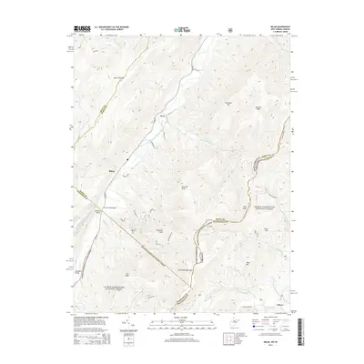
2014 Map of Milam
USGS Topo · Published 2014About this map
South Fork South Branch Potomac River carves a deep valley through this West Virginia landscape, providing a narrow corridor for settlements such as Milam and Peru. The map details a high-elevation environment dominated by the George Washington National Forest, where steep ridges like Shenandoah Mountain and South Fork Mtn rise sharply above the watercourses. The river's influence on local movement is evidenced by Trumbo Ford Bridge and the concentration of small farmsteads along Sweedlin Valley. To the east, the terrain transitions toward Criders and the German River, illustrating the complex borderlands where West Virginia and Virginia meet along several county lines. Notable landmarks include Nettie Davis Spring and Bergdeli, which anchor the local geography alongside numerous named peaks like Reynolds Knob and Haystack Knob.
Find a feature on this map
52 named features on this map. Tap any name to fly to it.
Don’t see what you’re looking for? This feature index may not catch every label — zoom into the map to look around manually.
Map Details
Editions of this 2014 Milam Map
This is the sole edition of this map. No revisions or reprints were ever made.
Other maps of this area

1892 · Franklin
USGS Topo · 1:125,000

1892 · Woodstock
USGS Topo · 1:125,000

1896 · Franklin
USGS Topo · 1:125,000

1920 · Petersburg
USGS Topo · 1:48,000

1921 · Orkney Springs
USGS Topo · 1:48,000

1921 · Petersburg
USGS Topo · 1:48,000

1922 · Fort Seybert
USGS Topo · 1:48,000

1922 · Petersburg
USGS Topo · 1:62,500

1923 · Orkney Springs
USGS Topo · 1:62,500

1924 · Fort Seybert
USGS Topo · 1:62,500