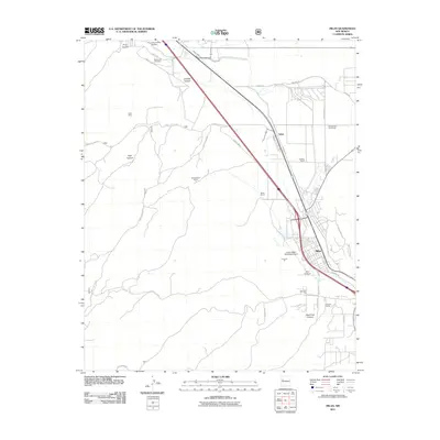
2011 Map of Milan
USGS Topo · Published 2011About this map
Milan serves as the primary hub of this landscape, situated at the junction of modern infrastructure and traditional ranching grounds. The town sits alongside the Rio San Jose and the historic W Hwy 66, reflecting its growth near the Grants-Milan Municipal Airport. To the north, the settlement of Toltec and numerous family holdings, such as the Stanley and Card Ranch and Schneemann Ranch, illustrate the region's enduring agricultural character.
Find a feature on this map
37 named features on this map. Tap any name to fly to it.
Don’t see what you’re looking for? This feature index may not catch every label — zoom into the map to look around manually.
Map Details
Editions of this 2011 Milan Map
This is the sole edition of this map. No revisions or reprints were ever made.
Other maps of this area

1883 · Mt. Taylor
USGS Topo · 1:250,000

1886 · Wingate
USGS Topo · 1:250,000

1886 · Mt. Taylor
USGS Topo · 1:250,000

1892 · Wingate
USGS Topo · 1:250,000

1892 · Mt. Taylor
USGS Topo · 1:250,000

1899 · Mt. Taylor
USGS Topo · 1:250,000

1951 · Mt Sedgwick
USGS Topo · 1:24,000

1952 · Paxton Springs
USGS Topo · 1:24,000

1954 · Gallup
USGS Topo · 1:250,000

1957 · San Rafael
USGS Topo · 1:24,000