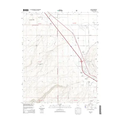
2013 Map of Milan
USGS Topo · Published 2013About this map
Grants and Milan serve as the primary hubs in this western New Mexico landscape, where the high desert terrain meets the jagged lava flows of The Malpais. The corridor is defined by transportation and water, with the Rio San Jose and W Highway 66 cutting through the valley. To the northwest, the settlement of Bluewater Village sits near the Bluewater Cem, while the sprawling Cibola National Forest covers much of the surrounding highlands. This 2013 survey illustrates the area's mix of municipal development, such as the Grants-Milan Municipal Airport, and traditional agricultural operations like Schneemann Ranch and Harding Ranch. The map also captures the varied topography of the Zuni Mountains foothills, featuring landmarks like Black Mesa and Zuni Canyon south of the urban center.
Find a feature on this map
71 named features on this map. Tap any name to fly to it.
Don’t see what you’re looking for? This feature index may not catch every label — zoom into the map to look around manually.
Map Details
Editions of this 2013 Milan Map
This is the sole edition of this map. No revisions or reprints were ever made.
Other maps of this area

1883 · Mt. Taylor
USGS Topo · 1:250,000

1886 · Wingate
USGS Topo · 1:250,000

1886 · Mt. Taylor
USGS Topo · 1:250,000

1892 · Wingate
USGS Topo · 1:250,000

1892 · Mt. Taylor
USGS Topo · 1:250,000

1899 · Mt. Taylor
USGS Topo · 1:250,000

1951 · Mt Sedgwick
USGS Topo · 1:24,000

1952 · Paxton Springs
USGS Topo · 1:24,000

1954 · Gallup
USGS Topo · 1:250,000

1957 · San Rafael
USGS Topo · 1:24,000