2023 Map of Milan
USGS Topo · Published 2023About this map
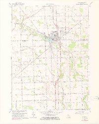
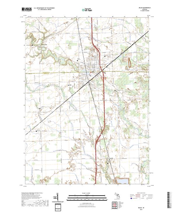
The city of Milan straddles the boundary between Washtenaw and Monroe counties, serving as the central hub for this rich agricultural landscape. The surrounding countryside is defined by an intricate network of waterways and drainage systems, including the Saline River and North Branch Macon Creek, alongside smaller channels like Sugar Creek and McIntyre Drain. This 2023 survey documents the modern layout of rural settlements such as Mooreville and Azalia, where the presence of numerous small cemeteries suggests long-established family ties to the land. Genealogists will find several burial grounds mapped here, ranging from the Marble Park Cem in town to rural sites like Old Saint Mary's Cem and the Rice Cem. The landscape remains notably divided by the rectilinear road grid of the Public Land Survey System, though natural contours are traced by the winding paths of Bear Swamp Creek and Stony Creek RD.
Find a feature on this map
96 named features on this map. Tap any name to fly to it.
Don’t see what you’re looking for? This feature index may not catch every label — zoom into the map to look around manually.
Map Details
Editions of this 2023 Milan Map
This is the sole edition of this map. No revisions or reprints were ever made.