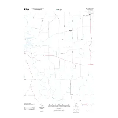
2013 Map of Milan
USGS Topo · Published 2013About this map
Laughery Cr carves a winding path through the heart of Ripley County, defining the eastern edge of Versailles State Park and the prominent Henderson Bend. This landscape is marked by a network of small watercourses, including Falling Timber Cr and Turkey Cr, which once supported the early agrarian economy of south-central Indiana. The town of Milan anchors the northeast corner, while smaller crossroads like Elrod and Stringtown represent the persistent rural settlement patterns that have shaped the region since the mid-19th century.
Find a feature on this map
56 named features on this map. Tap any name to fly to it.
Don’t see what you’re looking for? This feature index may not catch every label — zoom into the map to look around manually.
Map Details
Editions of this 2013 Milan Map
This is the sole edition of this map. No revisions or reprints were ever made.
Other maps of this area

1946 · Versailles
USGS Topo · 1:24,000

1946 · Milan
USGS Topo · 1:24,000

1946 · Pierceville
USGS Topo · 1:24,000

1946 · Osgood
USGS Topo · 1:24,000

1953 · Cincinnati
USGS Topo · 1:250,000

1956 · Louisville
USGS Topo · 1:250,000

1957 · Cincinnati
USGS Topo · 1:250,000

1958 · Sunman
USGS Topo · 1:24,000

1958 · Dillsboro
USGS Topo · 1:24,000
1959 · Rexville
USGS Topo · 1:24,000