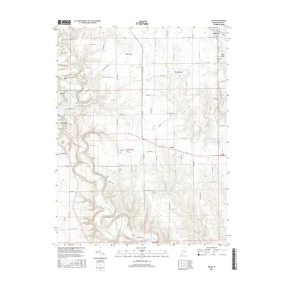
2016 Map of Milan
USGS Topo · Published 2016About this map
Laughery Creek carves a deep, winding path through this corner of Ripley County, shaping a landscape of high bluffs and sharp bends such as Henderson Bend and Cliffside. The western edge is anchored by Versailles, where the Versailles State Park Dam controls the waterway's flow. To the east, the settlement of Milan marks the upland plateau, while smaller communities like Elrod and Stringtown occupy the spaces between the creek's many tributaries, including South Hogan Creek and Caesar Cr.
Find a feature on this map
90 named features on this map. Tap any name to fly to it.
Don’t see what you’re looking for? This feature index may not catch every label — zoom into the map to look around manually.
Map Details
Editions of this 2016 Milan Map
This is the sole edition of this map. No revisions or reprints were ever made.
Other maps of this area

1946 · Versailles
USGS Topo · 1:24,000

1946 · Milan
USGS Topo · 1:24,000

1946 · Pierceville
USGS Topo · 1:24,000

1946 · Osgood
USGS Topo · 1:24,000

1953 · Cincinnati
USGS Topo · 1:250,000

1956 · Louisville
USGS Topo · 1:250,000

1957 · Cincinnati
USGS Topo · 1:250,000

1958 · Sunman
USGS Topo · 1:24,000

1958 · Dillsboro
USGS Topo · 1:24,000
1959 · Rexville
USGS Topo · 1:24,000