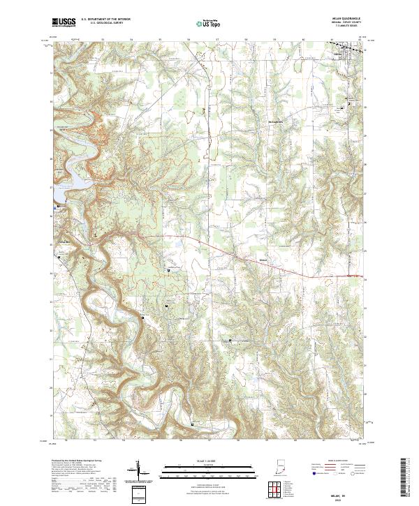
2022 Map of Milan
USGS Topo · Published 2022About this map
Laughery Creek carves a deep path through the limestone-rich topography of Ripley County, anchoring a landscape where small rural settlements like Elrod and Stringtown have persisted alongside established towns. In the northwest, the county seat of Versailles sits near the Versailles State Park Dam, a site where modern recreational boundaries overlap with older landmarks like Cliff Hill Cem and Hassmer Hill. To the northeast, the town of Milan is defined by its position along the CSX rail line, which continues to shape the local economy and spatial organization as it has for generations.
Find a feature on this map
100 named features on this map. Tap any name to fly to it.
Don’t see what you’re looking for? This feature index may not catch every label — zoom into the map to look around manually.
Map Details
Editions of this 2022 Milan Map
This is the sole edition of this map. No revisions or reprints were ever made.
Other maps of this area

1946 · Versailles
USGS Topo · 1:24,000

1946 · Milan
USGS Topo · 1:24,000

1946 · Pierceville
USGS Topo · 1:24,000

1946 · Osgood
USGS Topo · 1:24,000

1953 · Cincinnati
USGS Topo · 1:250,000

1956 · Louisville
USGS Topo · 1:250,000

1957 · Cincinnati
USGS Topo · 1:250,000

1958 · Sunman
USGS Topo · 1:24,000

1958 · Dillsboro
USGS Topo · 1:24,000
1959 · Rexville
USGS Topo · 1:24,000