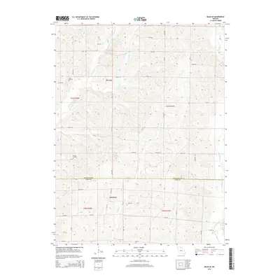
2014 Map of Milan SE
USGS Topo · Published 2014About this map
Enterprise and Paw Paw sit within a landscape defined by the intricate drainage of the Little E Locust Cr and W Yellow Cr systems. This agricultural region on the border of Sullivan and Linn counties is marked by a network of rural routes such as Highway UU and Texas Rd, which connect the scattered farmsteads and small crossroads. The map documents the presence of the Hollon Cemetery and Knifong Cemetery, essential landmarks for those tracing family history in this corner of Missouri. The terrain is characterized by dissecting branches including Long Br and Bear Br, which create a complex pattern of ridges and valleys that have historically dictated the placement of homesteads and section lines. Notable water features like Number 44 Lake and Paw Paw Cr serve as local focal points in an area largely defined by its persistent rural character and topographic texture.
Find a feature on this map
44 named features on this map. Tap any name to fly to it.
Don’t see what you’re looking for? This feature index may not catch every label — zoom into the map to look around manually.
Map Details
Editions of this 2014 Milan SE Map
This is the sole edition of this map. No revisions or reprints were ever made.
Other maps of this area

1946 · Brookfield
USGS Topo · 1:62,500

1948 · Brookfield
USGS Topo · 1:62,500

1949 · Bucklin NW
USGS Topo · 1:24,000

1950 · Bucklin NW
USGS Topo · 1:24,000

1953 · Moberly
USGS Topo · 1:250,000

1954 · Centerville
USGS Topo · 1:250,000

1954 · Moberly
USGS Topo · 1:250,000

1957 · Moberly
USGS Topo · 1:250,000

1957 · Centerville
USGS Topo · 1:250,000

1958 · Centerville
USGS Topo · 1:250,000