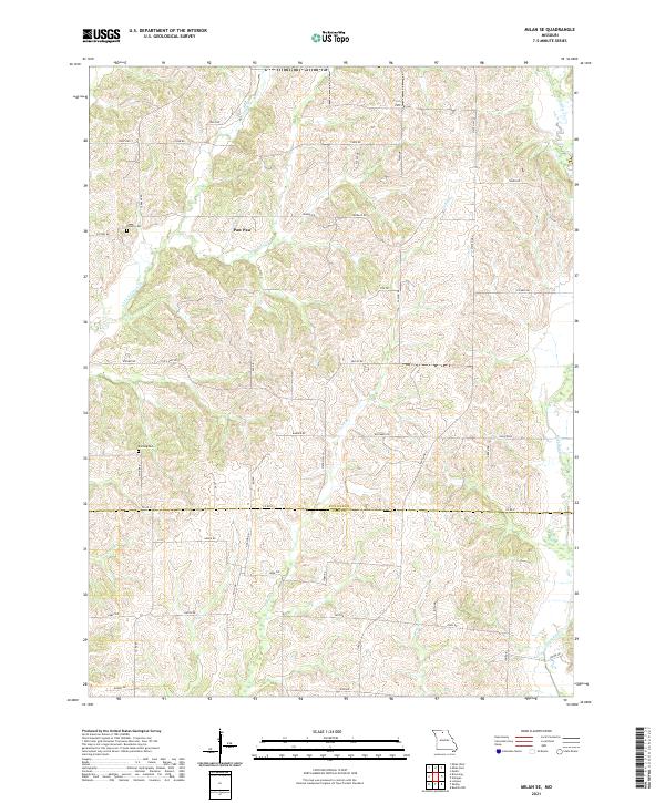
2021 Map of Milan SE
USGS Topo · Published 2021About this map
The rolling hills along the Sullivan County and Linn County border define this northern Missouri landscape. The settlement of Paw Paw sits central to a network of winding rural roads and creeks, including its namesake Paw Paw Cr and Little Locust Cr. For genealogists, the map preserves the exact locations of Hollon Cem and Knifong Cem, nestled among farm fields and timbered drainage basins. The area’s hydrology is dominated by a series of south-flowing waterways like Long Br, Mairs Br, and Bear Br that eventually feed into W Yellow Cr. The transport pattern is typical of the region's agricultural character, with state-maintained routes such as State Hwy T and State Hwy U connecting scattered homesteads and livestock operations via a dense grid of secondary roads like Tiger Rd and Hedge Rd.
Find a feature on this map
51 named features on this map. Tap any name to fly to it.
Don’t see what you’re looking for? This feature index may not catch every label — zoom into the map to look around manually.
Map Details
Editions of this 2021 Milan SE Map
This is the sole edition of this map. No revisions or reprints were ever made.
Other maps of this area

1946 · Brookfield
USGS Topo · 1:62,500

1948 · Brookfield
USGS Topo · 1:62,500

1949 · Bucklin NW
USGS Topo · 1:24,000

1950 · Bucklin NW
USGS Topo · 1:24,000

1953 · Moberly
USGS Topo · 1:250,000

1954 · Centerville
USGS Topo · 1:250,000

1954 · Moberly
USGS Topo · 1:250,000

1957 · Moberly
USGS Topo · 1:250,000

1957 · Centerville
USGS Topo · 1:250,000

1958 · Centerville
USGS Topo · 1:250,000