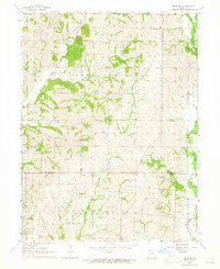
1964 Map of Milan SE
USGS Topo · Published 1965About this map
Enterprise sits near the heart of this rural landscape, which is defined by the winding drainages of Little Locust Creek and Paw Paw Creek. The area is characterized by scattered farmsteads and small rural landmarks that speak to the local history of north-central Missouri. Along the northern boundary, the Mt Zion Ch provides a focal point for the community, while the Helton Cem and Brittain Cem offer valuable locations for genealogical research.
Find a feature on this map
16 named features on this map. Tap any name to fly to it.
Don’t see what you’re looking for? This feature index may not catch every label — zoom into the map to look around manually.
Map Details
Editions of this 1964 Milan SE Map
This is the sole edition of this map. No revisions or reprints were ever made.
Other maps of this area

1946 · Brookfield
USGS Topo · 1:62,500

1948 · Brookfield
USGS Topo · 1:62,500

1949 · Bucklin NW
USGS Topo · 1:24,000

1950 · Bucklin NW
USGS Topo · 1:24,000

1953 · Moberly
USGS Topo · 1:250,000

1954 · Centerville
USGS Topo · 1:250,000

1954 · Moberly
USGS Topo · 1:250,000

1957 · Moberly
USGS Topo · 1:250,000

1957 · Centerville
USGS Topo · 1:250,000

1958 · Centerville
USGS Topo · 1:250,000