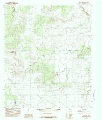
1984 Map of Miles NW
USGS Topo · Published 1984About this map
The Colorado River winds through the northeast corner of this West Texas landscape, which is defined by a complex drainage network at the intersection of Coke, Runnels, and Tom Green counties. During the mid-1970s, the terrain was dominated by the winding paths of Antelope Creek, Red Bank Creek, and the South Fork. These seasonal waterways cut through the limestone-rich plateau, creating a rugged topography of draws and mesas typical of the region's ranching country. Industrial infrastructure is sparse but present, notably the UIG Pipeline traversing the southern portion of the sheet. In the southwest, Willow Creek and Little Concho Creek further delineate the watershed patterns that have dictated local land use and property boundaries for generations in this part of the state.
Find a feature on this map
10 named features on this map. Tap any name to fly to it.
Don’t see what you’re looking for? This feature index may not catch every label — zoom into the map to look around manually.
Map Details
Editions of this 1984 Miles NW Map
This is the sole edition of this map. No revisions or reprints were ever made.
Other maps of this area

1891 · Hayrick
USGS Topo · 1:125,000

1894 · Hayrick
USGS Topo · 1:125,000

1921 · Baker Flat
USGS Topo · 1:31,680

1921 · Lowake
USGS Topo · 1:31,680

1921 · Maverick
USGS Topo · 1:31,680

1921 · Quarry Creek
USGS Topo · 1:31,680

1921 · Rowena
USGS Topo · 1:31,680

1921 · Mays School
USGS Topo · 1:31,680

1954 · San Angelo
USGS Topo · 1:250,000

1957 · Miles
USGS Topo · 1:62,500